Last 100+ degree day of the year please Lord.
Cold front coming
Cold front coming
Follow along with the video below to see how to install our site as a web app on your home screen.
Note: This feature may not be available in some browsers.
Looks like the last 90 degree day, here, will be tomorrow.Last 100+ degree day of the year please Lord.
Cold front coming
Yeah... I know you all will be VERY disappointed!Looks like the last 90 degree day, here, will be tomorrow.
70's for highs next week

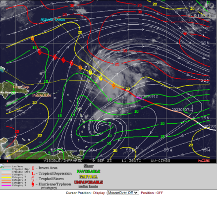
Lee has spent the day battling SAL and 20-25 kts of SW windshear.
NHC expects those conditions to continue for the next 12-24 hrs.
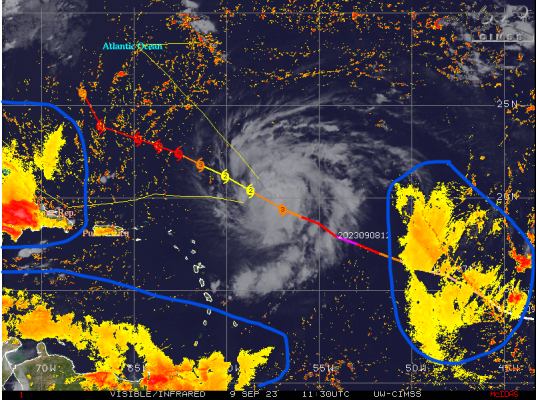
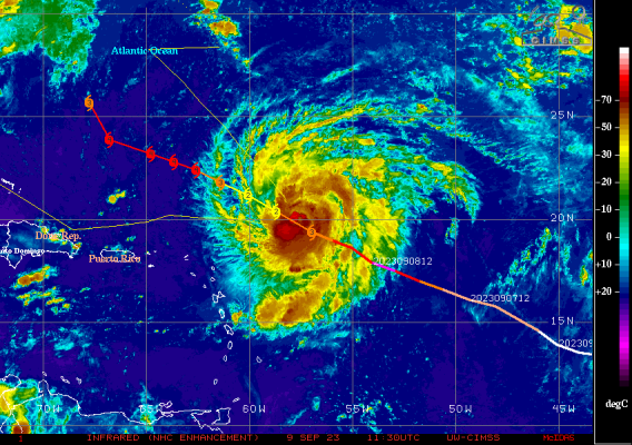
The latest recon flight found a ragged eye with max surface winds of 109 mph which is Cat 2.
Basically from a Tropical Storm to a Cat 5 in less than 24 hours. Then from a Cat 5 down to a Cat 2 in 12 hours.
View attachment 107031
There is enough kinetic energy there that it should rejuvenate once it gets back to favorable conditions.
View attachment 107028

Last 100+ degree day of the year please Lord.
Cold front coming
110 degrees in September is a bit much. Time to dial this shit back.

Dear Mister Sun: I’m not sure if you seen the calendar, but we’re done with you. Take your shit and go.
Dear Mister Sun: I’m not sure if you seen the calendar, but we’re done with you. Take your shit and go.
Lee has spent the day battling SAL and 20-25 kts of SW windshear.
NHC expects those conditions to continue for the next 12-24 hrs.
The latest recon flight found a ragged eye with max surface winds of 109 mph which is Cat 2.
Basically from a Tropical Storm to a Cat 5 in less than 24 hours. Then from a Cat 5 down to a Cat 2 in 12 hours.
View attachment 107031
There is enough kinetic energy there that it should rejuvenate once it gets back to favorable conditions.
View attachment 107028
Looks like Lee's eyewall has completely collapsed.
Recon was having trouble finding the COC.
View attachment 107034
Tuesday Sept 12th
View attachment 106921
Wednesday Sept 13th
View attachment 106922
Thursday Sept 14th
View attachment 106923
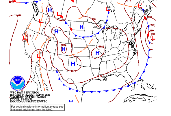
I got another day (Friday Sept 15th) added to the surface maps I posted yesterday.
No changes in that the Trough is still modeled to be in place and protect the US east coast from landfall.
If the Trough verifies and there's a landfall, it would be Nova Scotia or Newfoundland.
Those semi-circles off the coast of North Carolina/Virginia is Lee on it's northerly track.
View attachment 107002
There is currently a strong ridge of High Pressure (not shown) in the central and northern Atlantic. That is what's keeping Lee on it's current WNW track. That High expected to weaken come Tuesday 12th or Wednesday 13th. That's when we can expect Lee to take a northerly turn and ride between said US Trough and the High Pressure. Basically like a bowling lane with the kiddie bumpers up.
If the trough verifies, the more that High Pressure weakens will allow Lee to take a NNE to NE recurve. The timing and weakening of that High Pressure will determine whether there's landfall in Nova Scotia/Newfoundland.
The entire US East Coast will feel effects from Lee in the form of waves, surge, and riptides. There are going to be idiots out there wanting to get in that rough water to surf or whatever.


